Specific Service

Process & Safty Engineering
- Line / Equipqmnet Size Calculation and datasheets for Major Precess / Utility Equipment.
- Design and develop PFD, Process/Utility P&ID and Line list.
- PSV/Control valve Size calculation.
- Hydraulic Calculation for Flare line, Open drain/Close drain system.
- HAZOP/HAZID study for entire p&IDS.
- Process Safety time calculations for XSV,ESV for whole TOPSICES OIL & GAS Projects
- Maintain Master P&ID and update redline mark-up.

PIPING DESIGN AND ENGINEERING
- Detail Engineering for Equipment, Piping Layout and Design 3D modelling based on Process and project requirements.
- Process Piping Design.
- Utility Piping Design.
- Fabrication Isometric deliverables.
- Piping and Pipe supports MTO deliverables for Material procurements.
- Thermal Static Pipe stress Analysis and Design.
- Standard and custom pipe support for detail engineering phase and model pipe support based o stress calculation.
- Maintain Master P&ID and update redline mark-up.
- Piping team to involve supporting to Construction team for follow-on phase.
- As built the 3D modelling as per redline mark-up and update all GA drawings.
- Interaction with required discipline and discuss throughout the detail phase.
- Interference clash check.

CIVIL & STRUCTURAL DESIGN AND ENGINEERING
- Deep Foundations
- Mat/Spread Footings
- Slabs on Grade
- Module base structures.
- All Equipment Support Structures.
- Braced Frames
- Pipe Rack/Pipe Bridges
- Material Handling Conveyor items.
- Monorail/Hoist system
- Civil/Structural MTO deliverables for Material procurements.

Instrumentation and Control Services
- Control Panel Layouts.
- Control Room Layouts.
- Instrumentation location layout.
- Instrumentation installation/Mounting details.
- Instrumentation air Manifolds.
- Instrumentation Loop diagrams.
- Instrumentation Hook-up diagrams.
- Instrumentation Wiring diagrams
- Instrumentation cable block diagrams
- Instrumentation Index and I/O list.
- Cable tray/trench Routing Layout.
- Cable tray support consideration with Oglaend standard based on project requirement.
- Cable tray, tray supports MTO deliverables for Material procurements.
- Fire and gas protection &security system layout.

Electrical Engineering Services
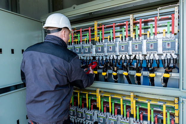
- Single Line Electrical diagrams.
- Main Substation Planning Layout.
- Electrical Power distribution systems.
- Motor Control centre Layouts.
- Indoor/Outdoor Lighting Layout.
- Electrical Floor plan Layouts.
- Earth Layout, Lighting protection system.
- Earth Layout
- Cable tray Routing Layout.
- Cable tray support consideration with Oglaend standard based on project requirement.
- Electrical Installation/Mounting details.
- Electrical tray and supports MTO deliverables for Material procurements.
- Feasibility study.

Material Handling System Design
- Design and Selection of Monorail based on Components items weight.
- Review and allocate reserve space for Material handling.
- Design Davit arrangements based on weight of items at drop zone.
- Motor removable.
- Structural Lug Support.
- Develop the Material handling path layout.
VIRTUAL WALKTHROUGHS
A 3-D model effectively demonstrates most aspects of a project or the impact of changes in immediate, easily understood images. Real-time walkthroughs in the digital model allow for comprehensive understanding of the facility prior to construction.

3D SOFTWARE CAPABILITY:
- Smartplant 3D 2018(SP3D)
- Aveva E3D 3.1
- Caesar II 2019
- Cadwork 3D
- Intergraph Smart Instrumentation Intools SPI.
- Smartplant P&ID
- Aveva Intelligent P&ID
- ETAP-Electrical Power system Analysis
- Dialux lighting
- Staad pro Structural analysis and design
- Autocad
- Microstation
- Naviswork Manage
3D Digital Modelling Provides:
- 360° Views of Project 3D models.
- Easier reviews of design status.
- Animated walk-through.
- Facilitate planning across all Discipline.
- Internal/External P&ID and Piping reviews.
- Interference Detection check.
- Preventive Maintenance reviews.
- Quality Assurance
- Quality Control


3D Laser Scanning Services:
Laser Scanning gives our team a virtually endless number of node points that can be used in 3D CAD models. This helps facilitate constructability reviews and allows for a higher accuracy in locating new geometry and connecting tie-in points. Point Clouds have been crucial in MSV completing projects without field interferences with existing infrastructure.
3D laser scanning provides a high level of accuracy to any project requiring field measurements or as-builts. A 3D laser scan uses a concentrated beam of light to digitally map the surface of any object. The laser sweeps the object to create millions of points called a “point cloud” which is used to extrapolate the object’s shape, location, and even colour.
This is ideal for many project field information gathering needs, including (but not limited to) the following:
- Field measurements
- Data-Driven
- Digital Planning
- Creating accurate As-built Drawings based on laser scanning and available GAD.
- Reducing Interferences and improving the accuracy of the existing connections.
- Animated walkthrough.
- Conversion As built 3D model from existing GA drawings and Laser scan data.
Location
400 Balestier Road #02-39, Balestier Plaze, Singapore - 329802
Call Us
(+65) 9859 6432 / 8511 9475
